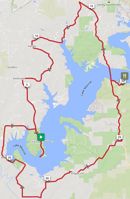
Scenic Route: 40 miles, 2,200 feet of climbing, 3 boat ramps

Details
-
This is the route with minimal boat ramps.
-
A SAG stop with snacks and water is at Ramp 3 (Cartop, at about mile 11). This is one of the 3 ramps on this route.
-
Ramp 6 (Cutright, 20 miles) is the full SAG stop with food, water, Gatorade, and a restroom. It is staffed by the Friends of Lake Monroe. Say hello and talk to them about the lake.
-
Suggested options.
-
Remember—the extra ramps are optional. If you are feeling it—try one.
-
Your wristband will get you into Hardin Ridge National Forest Recreation area (26.5 miles). It is a beautiful area and has water, restrooms, and a nice overlook (on the left) to see the lake. You will know when to turn around to avoid the hill.
-
At the top of the hill just past the Monroe dam is the Dam Overlook (35 miles, follow signs to ramp 10). You will find a nice view, water, and restrooms. Don’t go down the hill to ramp 10.
-
-
Join the Tour de Ramps Facebook community for more looks at the route and its challenges!