Blog Post

pRAIN STORM

By John Bassett

When I wrote a blog post about last year’s pre-RAIN ride (pRAIN) I titled it “PRAIN in the Rain”.  Unfortunately, as it turns out, I should have reserved that title for this year.  So, for lack of a better title let me call this “pRAIN STORM” (Pre-RAIN Same Thing only Rain More).

A nice group of BCC and affiliated riders arrived in Terre Haute last Friday evening in preparation for an early Saturday start to the one-day one-way 160 mile bicycle adventure that is the RAIN route.  Well, that is not exactly true.  Dave, who had ridden a touring bicycle to pRAIN from Kansas City, did not arrive in Terre Haute until 4:30 AM, having completed a 225 mile ride through most of the night to get there.  This was after spending the previous week at the Tour of Colorado!  After changing a tacoed wheel with a replacement Dana had brought over and loading up on some caffeine, he was sort of ready to go.

Assessing the weather early Saturday morning, we realized there was going to be little chance of staying dry.  The best we hoped for was to get started before the rain hit.  We did not get all our ducks in a row very early and got off to a rather late start.  Here we are all lined up at the RAIN starting line at St Mary’s Road and US 150 (left to right – John, Jen, Zack, Stan, Ron, Eugene, Mike, Cissy, Dana, and Dave).

We managed to roll out promptly at 7:30AM, and were able to get all the way over to the east side of Terre Haute before the first wave of rain hit.  We got thoroughly drenched for an hour or so and spent the rest of the morning in and out of passing showers.
We took our first break at Putnamville / US 231 where our cadre of SAG support vehicles had assembled.  We very much appreciated the services of Cissy’s sister, Sasha, Jen’s sister, Lynnae, Eugene’s wife, Teresa, my wife, Susan, and Ron’s wife, Janet (my sister-in-law) in supporting this event.  We sincerely appreciate their efforts.
For the remainder of the day, we rode Jim Schroeder’s 2013 RAIN route exactly, following the trail of yellow raindrops that the BBC had placed earlier in the week.  I can attest to the fact that those yellow raindrops show up very well on wet pavement!  The 2013 route is slightly different than 2012.  As shown on the map below, a loop is added south to Mooresville and basically the entire length of Edgewood Avenue is used in lieu of Thompson Road along the south side of Indianapolis.  There are also a couple of other minor changes, but the entire route remains 160 miles (160.2 miles if you prefer that level of detail).

We rested a moment at the city park south of the Plainfield Middle School which serves as Rest Stop 2 of RAIN.  We had a leisurely lunch at the Subway at the intersection Southport Road and Bluff Road (Mile 81.5) almost exactly half way along the route.
At lunch, Stan noted that every time he cleaned off his glasses it would rain.  He cleaned his glasses, and I cleaned mine.  We soon found ourselves in a genuine downpour heading north on Bluff Road.  We decided it would be best if we did not clean our glasses again. 
Eugene took a small break to put on dry cloths and warm up after lunch.  He came back at Greenfield with a vengeance, taking on a couple of massive 10 miles pulls heading east on US 40 from Greenfield.  His efforts along with a very nice tail wind, particularly during surges of rain, allowed a group of five of us to average 22 to 26 mph over long stretches of US 40 east of Greenfield.  This was delightfully pleasant riding, when it was not raining.
We regrouped for a final time at SR 1 near Cambridge City about 13 miles from the finish, allowing Mike and Cissy, who had flatted, time to catch up.  Most of us arrived in Richmond within a few minutes of each other.  Here are Cissy and her brother Mike doing a little celebration thing at the soon-to-be RAIN finish line at Earlham College.  These guys, along Cissy’s twin sister Sasha, are a real dynamic trio.
It was fun to have all of them along.
Dave and Dana arrived only a short time later with Dave expressing his gratitude for Dana’s strong pulls in the latter part of the ride.  It was a remarkable achievement on Dave’s part.  He seemed to get stronger throughout the day, and Dana was there every pedal stroke. 
Initially, I was very pleased with my best-ever moving average speed of 18.2 mph.  That was until Eugene told me he was well over 19 mph!  I also had a personal best total time, which could have been even better had I not spent so much time off the bike socializing.  But, that is what happens when you ride with such a great group of people.
We concluded the day by loading up and driving back to the east side of Indianapolis where most of us enjoyed a very fine Mexican dinner.
This weekend is the real RAIN.  By doing the pRAIN thing, I have both the satisfaction of both doing this great ride and helping the BCC on event day.  It really is the best of both worlds.  The rain was pretty miserable at times, but I concentrated on enjoying that first-ever tailwind!  It was a great day.
Good luck to all you RAIN riders!

Mother Century

Three of us (Allan, Kelly, and Jim) did Jim’s midweek “Mother Century”, a drive-and-ride out of Columbus. Kelly is from Columbus and found the ride via the RAIN Facebook page and its link to the Southern Indiana Centurions FB page. Allan and Kelly were training for RAIN. Jim just does centuries.

The ride took us ENE on a clockwise loop out of Columbus, passing through towns important to Jim’s mother’s growing up in Indiana. We passed near Hope (of Hope Ride fame), Greensburg (Honda factory and tree growing out of the top of the courthouse), Oldenburg (German town where we at lunch in a cafe downtown), and Jim’s mother’s childhood home near Milhausen. The large country house appears to be well-maintained by the current owners.

The day started along the Peoples’ Trail in Columbus. We took a bit of a detour to get off of some loose chip and seal. We also had something of a head wind out of the east and were looking for a nice tail wind later in the day, which unfortunately never materialized.

Although the majority of the route was pretty flat by Bloomington standards we did encounter some climbing toward the middle of the route near Oldenburg. Even so we did finish with a 15.2 average for the day.

It was shortly after Milhausen that we encountered a couple of miles of gravel that was very slow going, where we averaged between 5 and 10 mph, also significantly reducing our average for the day. Jim noted that it was worse than it had been last fall. By and by Jim had a flat. The repair didn’t go so well as the tire didn’t seat right in the rim and Jim had to use his last tube and borrow a CO2 cartridge to make it right. Jim did allow as how we probably should have backtracked from his mother’s place to avoid the gravel!

And no rain! Altogether a great ride!

Clay City True Century with Updates

This route grew from Joe’s 96 mile “almost a century” to 98 miles by the time an alternative route was picked between Spencer and Patricksburg Road in order to avoid STR 46 entirely. With at least a mile each way between home and park, I ended the day with 100.4 miles, my first true century of the season.

We had 12 eager riders show up at 8 AM for the early start. Of those one, Ron, turned at SR 43 in order to get back to town in plenty of time to attend the Taste of Bloomington, where he expected to engage in advocacy activity, with the large number of city and county officials in attendance. In addition Ron rode the entire route by himself on Tuesday and thanks to him we had the alternative route out of Spencer. Ron is adopting a plan of appending to official club maps a page of alternate routes and updates. That’s how he shared the excellent alternate route for today’s ride.

Three more, including Andy, Tim, and Ben… came on into Spencer but departed another way to do a 63 mile “short” option.

The remaining 8 of us embarked on Ron’s proposed detour route. It was a nice road, but did seem to add significantly to the hill climbing for the day, 5800 feet of ascent according to my GPS/ The rest of us stuck pretty well together.

We had lunch at the A and W in Clay City, where “refills are free” on the root beers in cold mugs.

From there we engaged in some of the traditional pace-lining, over the next 10 miles or so averaging over 17.5 mph. (This OWLish group averaged about 14.2 for the entire 100 miles.)

By this time the day was seriously heating up and we were starting to feel it. We stopped again in Worthington for drinks and AC

By the time we got to Solsberry and Yo-Ho’s around 2 PM we were all wilting some more. Dana needed to be sure to be back home before 4 PM so she took off on her own (and ultimately made it home by 3:35 she reported). The rest of us lingered in Yo-Ho’s over cold drinks and ice cream. By the time we were leaving around 2:30 a cold front and clouds were coming through, and we began to feel a little better. We made a last short regouping at Whitehall and took off for the last 10-12 miles home. But by the time we got onto Vernal Pike it was sprinkling and soon turned into honest rain for the entire rest of the ride. (Dana reported that she, too, got caught in the rain just as she was crossing 37.) The Taste of Bloomington was pretty empty when we went by close to 4. We all agreed that rain is better than 90+ degree hot sun. But we were all quite soggy in the end. Allan, Dan, and Steve were the lead group in the end, with CE, Ken, Tom and Thom just slightly behind.

We got home before 4:30, dripping wet in steady rain. After a warm shower the next task probably should be to wipe down the bike and oil the change. Check and check.

We never saw any folks from the 9 AM group. I guess that means they got caught in the rain even further out than we did. I hope to add their report of the day’s events.

Added Monday, from John Bassett:

 It sounds like the 8:00 group fared better than we did.  I was kind of mid-pack in the 9:00 group riding with Bob DeGroff and Dana Fielding.  All told, after lunch at Clay City we got rained on three times and hailed on twice.  Hail was a new experience, but was OK until the lightening started.  So, we took shelter in a barn south of Coal City and were soon joined by a farmhand who had been planting beans.  There we were, all dripping wet.  For the next hour, we heard a monologue all about the wet spring weather as it pertained to corn, beans, and hay.

Bob and Dana were itching to get started again so we took off south for Worthington when the rain had almost stopped.  But we hit another big storm that hailed on us again and was accompanied by a fierce crosswind.  We raced through the storm to a convenience store in Worthington.  The temperature had plummeted and Dana was shivering uncontrollably.  Inside the store was cold, but there was no wind.  Outside the store was a little warmer, but the wind blew you sideways.  My bike that was leaning against the building blew over and my helmet rolled away.  I thought somebody had stolen it, but I found it about 50 feet downwind.

When the lightning stopped, we headed out east on SR 157.  One mile east of town it had not rained at all!  Soon however, another black cloud rolled up from the south.   We discussed whether or not we could get to Yoho’s before we got pounded again.  We did not.  We did the Three Sisters and all that stuff south of Newark in the rain, and arrived at Yoho’s saturated. I called my wife and told her we were a bit delayed due to storms but would be in Bloomington in an hour or so.  She said not to hurry because Bloomington was under a flash flood warning!

Bob suggested we take a short route back and not even try to ride back to the park.  Bob usually does not say this kind of thing, but these were extenuating circumstances.  We all agreed and decided to follow the Hilly Hundred route to Hendricksville and Gardner Road back to the south side of Bloomington.  This last 20 miles was in continuous rain, making this a pretty epic day.  But, we all had in excess of 100 miles for the day and that was worth the effort.

There is something to be said for leaving early.

Donation TO the BBC!

The club has just received a donation of almost $400 from Bloomingfoods, together with the City of Bloomington and Upland Brewing Company, as an outgrowth of the National Bike to Word Day Block Party in May. Read their letter! And then think how we can work together to advocate and promote safe and enjoyable biking in our community.

Double Century 2013

by Jim Schroeder 

Six BBC members started from Bryan Park at 6am on Saturday to attempt a double century, i.e. 200 miles in one day.  They were Dave Tanner, Paul Toth, Tammy Berger, Sid Tongret, Jack Ketchum, and Jim Schroeder.  This is a once a year type of ride so we didn’t know what we were getting into.  Thanks to Sylvia Schroeder and Jen Miers with Jackie O to assist us in two support vehicles.  We started off with a very cloudy morning going southward on the familiar route to Springville and some sprinkles kept us cool but not wet!  Dave, Paul, and Tammy powered ahead with Jim in the middle and Jack & Sid pulling up the rear.  This was to be the line up for the entire day.

After Springville, the route turned westward on IN-58 all the way to the present terminus of I-69.  It flattened out to mere rollers, and downhill speeds reached 40 mph!  The sun finally cooked off the clouds as we continued westward onto some country roads weaving I-69.  I later found out that this area was where Jack grew up and he just wanted to ride that area and quit when the body decided to stop.  We approached a church on a hillside and with the angle of sun upon it created a picture postcard of southern Indiana.

Turning southward now toward the Amish country of Oden we crossed over the last of the rollers and woods for some time.  About a dozen BBC’rs greeted us at the Essen Haus in Oden.  They were encouraged to do a drive and ride century from Oden that promised to be flat!  This would also keep us company with a chance for some much needed rest while drafting in a pack. They were chomping at the bit when Sid finally arrived, and the pack of fifteen now were off to the races at no less than a 20 mph clip.

I was pulling up the rear keeping Sylvia on track and bogeying a few riders every few miles.  At Washington a caboose formed comprised of Brett, Rachel, Sara, Jack, Sid, and myself, as we ventured into the low country of the West White River with all the “houses” elevated on stilts. Earlier in May Glenn Berger and I had to make 4 water crossings to stay on route on our exploratory midweek century. At mile 87 Jack and Sara opted for the comforts of the Subaru, while the rest of us forged on to Vincennes.  We soon lost Brett who went on ahead but he met back with us at the Subway.

The front pack was averaging about 20 mph while keeping Paul,Dave,and Tammy happy and they stopped for lunch at Subway.  They departed about the same time that the caboose arrived for lunch.  Rachel opted to skip lunch and jumped on the high speed train into old Vincennes and the George Rogers Clark Memorial on the Wabash River.  Brett appeared while we were eating, and we all opted to skip the old town tour, but since the service was so slow at Subway, we were still quite behind the front pack.  Brett was a sight for my sore eyes as he paced me all the way to Sanborn, where I had to convince him to turn east back to Oden for his 100 while I continued northward on the 200 mile route. Tammy also went east on the middle century route as planned as she totalled 140 miles for the day.

Paul and Dave surged ahead at a blistering pace for a double century.  Paul finally pleaded to Dave to slow down a bit.  Dave responded, “Oh, I was going this fast not to disappoint you!”  At Clay City, they were averaging 17.7 mph!  This northerly stretch was all new territory to me with Goose Pond wetlands south of Linton.  I had a long break in Linton with some coke and a cave towel to cool me down.  The stretch from Linton to Clay City had a lot of traffic especially as we merged onto the IN-39 pickup truck traffic from Jasonville.  Clay City had a town festival that evening, as Sid ignored the yells from Jack and Sylvia, probably looking for an elephant ear.

I was apprehensive of the Patricksburg hills.  They slowed me down a little, but the struggle was less than expected, as I entered Spencer at 8:15pm.  By the time the Subaru got to the CVS at 8:30 pm I decided to start riding as daylight was being depleted.  I found out later that Sid, stopped his double century quest at Spencer. I finally finished at 10:15pm with a tail light but no head light.  It only was a problem when under a canopy of trees as the moonlight and city light was blocked.  The last five miles though were in the city and the B-line trail.

Remember a few years ago, we bikers were always yelled at, “Hey, Lance, way to go.”

I’m sure, due to my slim build, as I passed the Seminary Square Krogers, I heard a yell, “Hey, Tanner.”

Bluegrass Cycling

By John Bassett

I usually don’t blog about a trip that has not been announced to the membership in general, but I want to make a small exception this time out.  Last weekend’s Horsey Hundred in Georgetown, Kentucky (the Horsey) was attended by no less than 21 BBC members, so it almost counts as an official club ride.  This was the 36th running of this classic event put on by the Bluegrass Cycling Club (BCC), but was my first time to attend.  Having heard stories of beautiful country scenery, well-kept horse farms, and quaint towns and mills, I just had to give this one a try.  Besides, this annual event is only an easy 3 ½ hour drive from Bloomington.

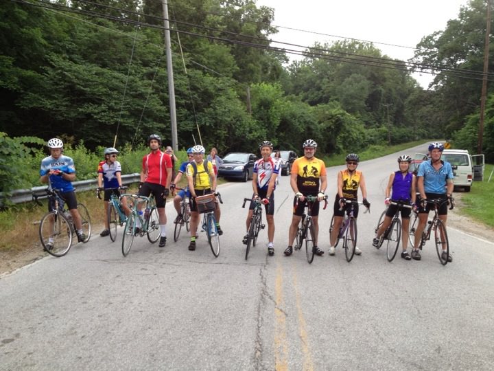
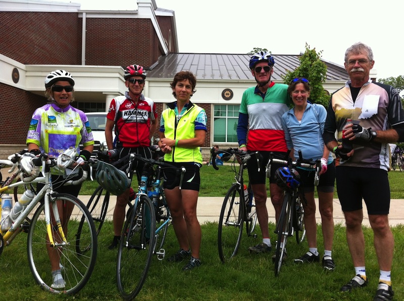
Susan and I headed down Friday morning, her intent being to soak up some scenery while I tried my first venture into Kentucky cycling.  We rendezvoused with Glenn and Tammy and Dan and Cindy in Georgetown for a casual Mexican dinner and to plot out our adventures.  We arranged to meet Jen, Andy, and Martha for the 8:00 AM mass start Saturday morning.  This is horse country, so the ride start is announced by a traditional “Call to the Post” bugle call performed by the real guy from the nearby Keeneland racetrack.

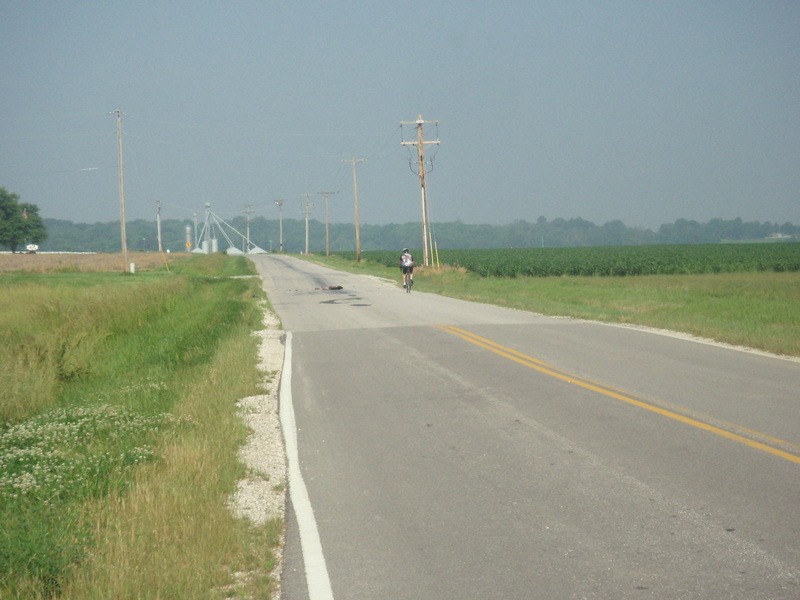
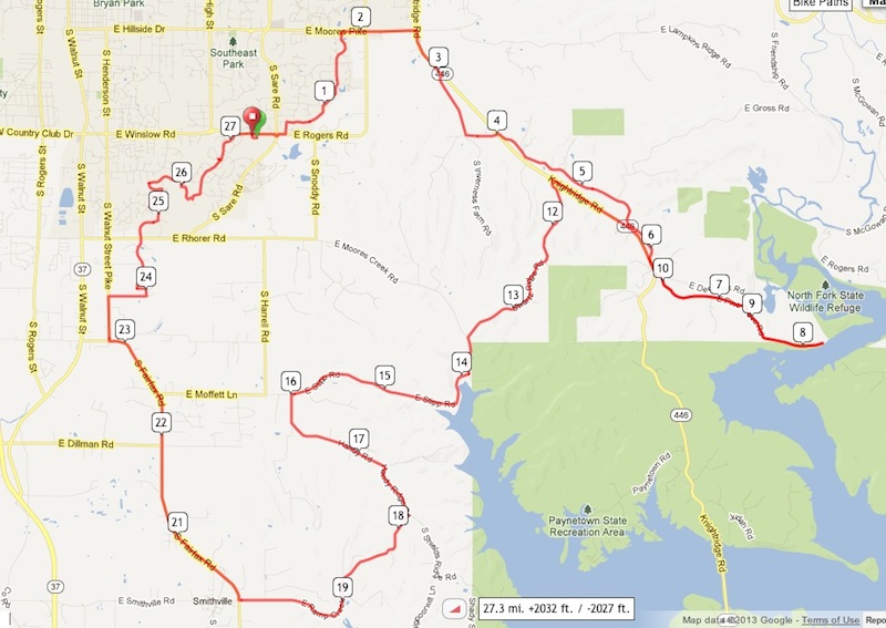
Think of the Horsey as a Springtime Hilly Hundred with multiple-distance Saturday and Sunday options.  This year’s event drew about 2,000 riders.  It is smaller than the Hilly, but has its own unique flavor and character.  All routes start in Georgetown, just north of Lexington, at the Georgetown College recreational center, which serves as the center for event activities.  The long route for Saturday is the traditional “Horsey 100” which this year was mapped out at 104 miles.  A large number of the Bloomington contingent did this. I tagged along for the day with Glenn, Tammy, and another Glenn from the Bluegrass Cycling Club who shared his knowledge of the routes and history of the area.

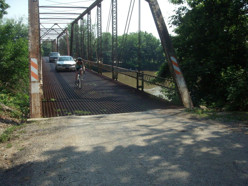
From Georgetown, the 100 mile route dipped south of I-64 and went through the historic town of Midway.  We then did a big north loop and plunged down into the Kentucky River valley north of Frankfort.  Riding past several bourbon whiskey warehouses, we followed a community bike path south for a lap around the historic Kentucky State Capital.

I was told the Bluegrass Cycling Club (BCC), wanted to make a hillier route this year.  They succeeded.  As shown on the profile, there was a lot of climbing to do from about mile 30 to mile 70.  The Kentucky River and tributaries are entrenched about 400 feet below the rolling Bluegrass uplands in this area, and you spend a lot of time south of Frankfort climbing in and out of the valley.  Leaving the valley about Mile 70 the route loops through Keeneland back to Georgetown.

Total climb for the Saturday ride was listed as 7,800 feet, which was within 100 feet of what our GPS units recorded.  The big hills in and out of the river valley were on modest highway grades and were therefore not overly difficult.  What makes this 100 miler challenging, and what makes cycling in Bluegrass challenging in general, are the seemingly endless upland rollers.  There is no level ground.  The small hills act in combination to wear you down on a long ride.

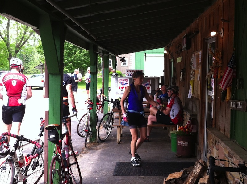
The BCC has a great answer to this problem – lots of rest stops.  No, I never did find any Hilly Hundred fried chicken, but these guys do a great job with the food – peanut butter sandwiches, bananas, oranges, potato chips, some great oatmeal ginger cookies, and oh yes, the ubiquitous dill pickles.  You really need to try pickles while riding, but I would not recommend doing over a dozen at one time.  It took a few miles to recover from that.

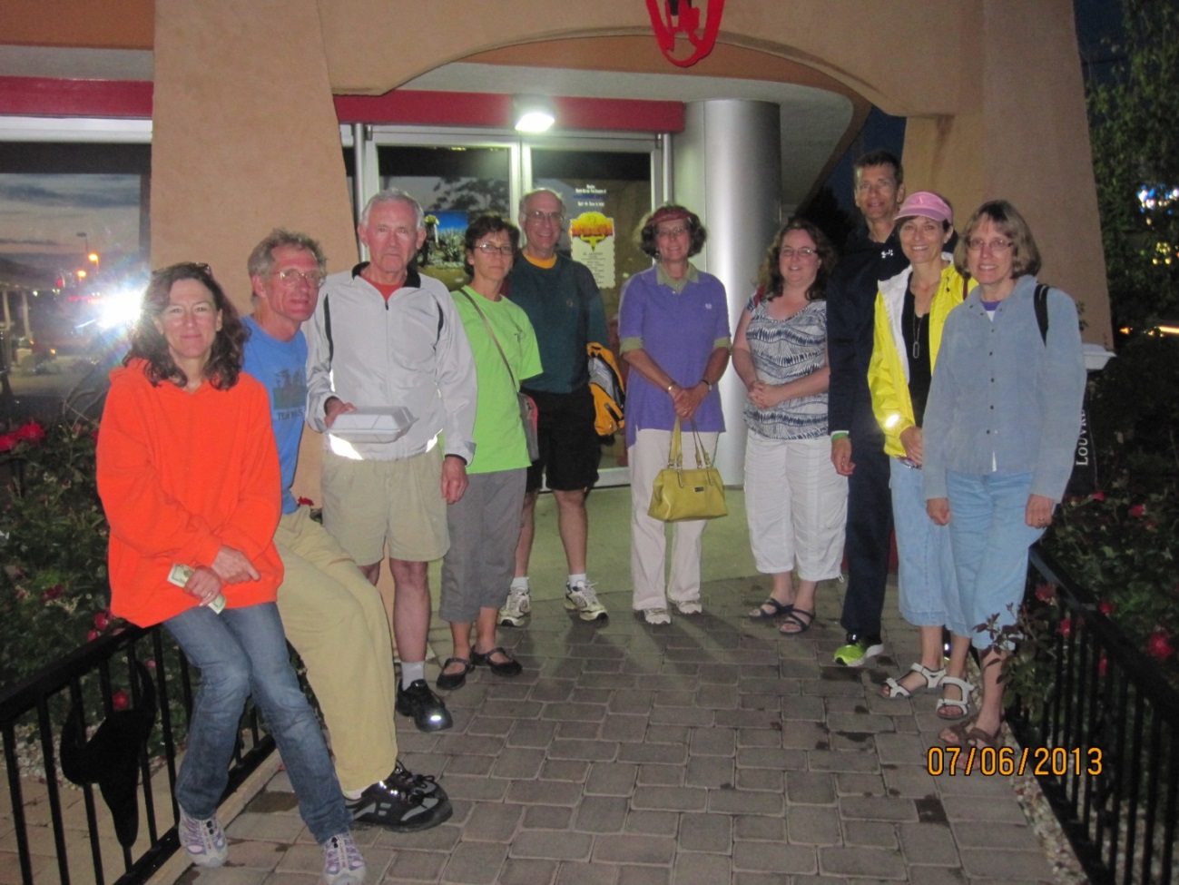
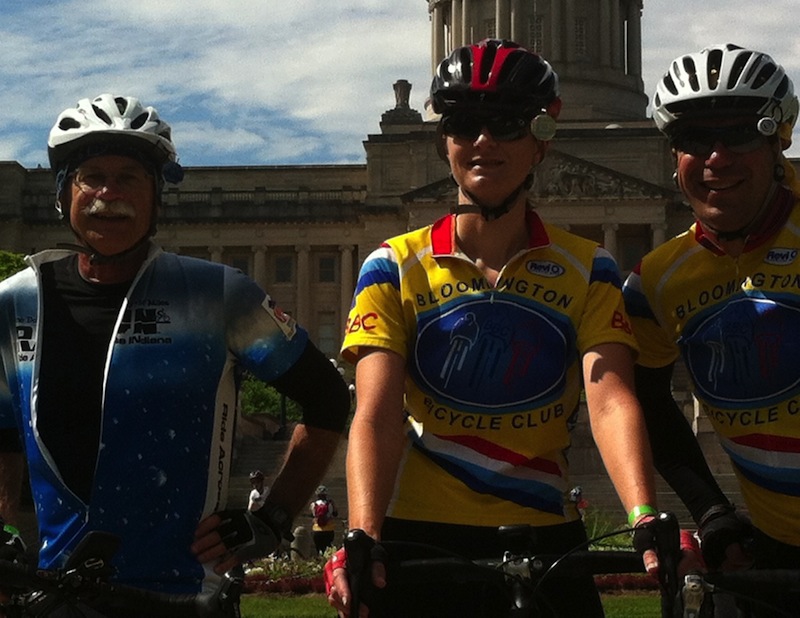
I don’t want to get hung up on food here, but another nifty thing about this event is that you can quite literally end your ride and get off your bike within 30 feet of the post-ride chow line.  This little bennie is included in your registrations and features tasty sandwiches of many types, salads, and chips.  You don’t even have to take your shoes off as the whole event is outdoors!  Here is some of the Bloomington contingent before diving into a post ride feeding frenzy.

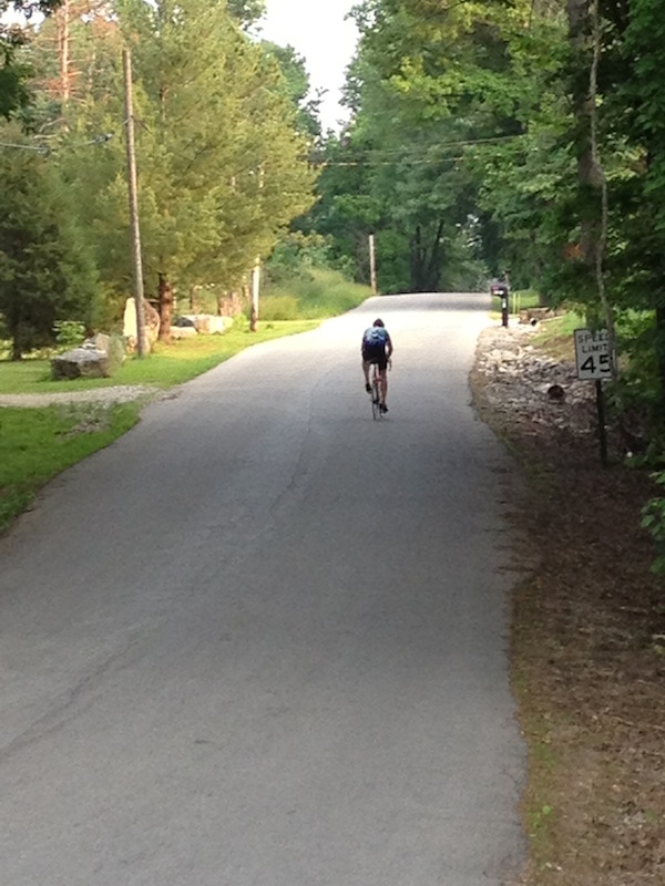
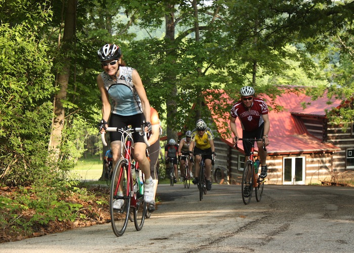
On Sunday, the rides are a little shorted, but I would not say easier.  All of the rides went east of Georgetown to the Paris area.  Many of the Bloomington contingent opted for the longest 75-mile route. This is roller city; the farther east you go – the bigger the rollers.  I was glad to get that ride turned around and headed back west.

Overall, this was a very nice weekend.  Thanks to the BCC for putting on this great event.  The routes, maps, road marking / signage, scenery, and food were all excellent.  I’ll plan on doing this one again.  Mark your calendar for the Horsey Hundred next year.

Special recognition goes to three Bloomington riders: Martha, Dana, and Rachel all completed their first centuries on Saturday.  There might even be others I don’t know about.  Congratulations, everyone.

The Best Ride in Indiana?

By John Bassett

Well, probably not – but it was a good one nonetheless!  On May 18 we tried something a little different on the Saturday club calendar and did a drive and ride to the Columbus area.  The route was published on the Bicycling Magazine website last year and was touted as the best ride in Indiana.  Who could not do such a ride!?

I had blindly put the ride on the club calendar in February.  Scouting it last month I had found the terrain a little hilly, but the roads and deep forest setting surprising pleasant.

After a brief rendezvous at Bryan Park to pick up a guest, Greg, from South Bend, Stan and I headed off to the designated starting point at the Jay C on the west side of Columbus.  By the 10:00 start time we had, by my count, 21 riders assembled BBC riders.  The official route was 56 miles with a 38 mile short option; all elected to go long.

The route starts with a long, gradual climb up the geologic Knobstone Escarpment on West Georgetown Road.  Turning south, you descend, cross SR 46, and climb again on Four Mile Ridge Road.  Valley Branch Road presents one stout climb and a nice downhill run before you junction with SR 135 just outside of Stone Head.  This is a pleasant section that extends on east along Bellsville Pike to Pike’s Peak.  Arriving in Pike’s Peak we were surprised to run into Klaus who had ridden his own route from Bloomington.  I was also surprised to see a bicycle aid station passing out bananas and cookies.  This, we found out, was associated with a separate bicycle tour being run at the same time by the Columbus club – friendly folks, but alas – no cookies for the BBC.

Crouch’s Market in Pike’s Peak is the only good place to refuel.  But, by riding a figure-of-eight, with Crouch’s in the middle, the ride has rest stops at 19 and 38 miles which divides the ride into three, about equal, parts.  The stops conveniently come after a couple of the more strenuous hilly stretches of the trip, Valley Branch Road headed south to Pike’s Peak on the north loop, and Christianburg Road heading north to Pike’s Peak on south loop.  Crouch’s, I must add, makes great sandwiches.  I had one at 19 miles, and it was so good I stopped for the “chicken salad special” at 38 miles.  Be sure to ask the nice lady at the cash register how Pike’s Peak – located in a valley – got its name.

Leaving Pikes Peak, the south loop of the Figure-of-Eight extends down Poplar Grove Road with yet another steep, but relatively short climb.  You join the Nashville 90 route at Spurgeon’s Corner and ride about two miles of the 90 in reverse.  The route follows Buffalo Pike, Houston Road, and Christianburg Road back north to Pike’s Peak.  I can best describe Christianburg Road as Rockport on steroids!  Does the road have a level section.

After leaving Pike’s Peak the second time we headed east out of the Middle Fork Salt Creek Valley and up the biggest climb of the day.  Our group got pretty strung out at this point.  I tried to stay in the middle of things and attempt to redirect wrong turns up front and assist stragglers off the back at the same time.  But we did pretty well, with Ron, Sid, Jack, and Ysusf doing a little extra credit, and Zack, Gregg, and the new guy with the vintage carbon fiber Look doing a lot of extra credit.

After a tour of the magnificent homes around Grandview Lake, the ride leaves the geologic Norman Upland, levels out, and heads back north into the Columbus ‘burbs.  We made some real time on this stretch getting to stretch our legs with some high gear work.  Back at the Jay C, a stone’s throw away, is Dagg’s, a very nice little ice cream shop.  This place totally made up for no bananas or cookies at Pike’s Peak, and was a great way to finish the ride.

We all had a good day.  I finished at 56 miles with a modest 3,800 feet of climbing.  As Stan said a couple of times: “None of these hills are named, but there sure are a lot of them”.  The route is well designed, suiting riders of various abilities.  There were several comments to include it on the ride calendar again, so we likely will.

Three Ramps on a Spring Evening

This ride was laid out by Gail Morrell (and mapped by CE Taylor), in part to avoid road work on Harrell: 446 and Knightsridge Road to Pine Grove; down and back up from the boat ramp; down Swartz Ridge and up Stipp; then Handy and down and back up Ramp Creek; back into town via Fairfax and Cardinal Glen.

Gail writes

It was a great ride!  Fifteen people showed up and 12 did the whole ride.  Three people had to cut it short due to time constraints so they turned right at the bottom of Swartz Ridge, while the rest of us went up Stipp and then out to Ramp Creek.  I found out later that evening after I got home that Harrell is paved and back open again.

Klaus Rothe, unofficial club photographer, took this opportunity to document the ride. Here’s his photo from the climb up from Pine Grove boat ramp:

Click here to view OWLS ride 3-16-13 (Album of 37 great pics.)